Smooth Sailing: How to Travel Talbot County’s Waterways
Centuries ago, native people carved canoes from poplar logs and used them to cross the rivers of what would become Talbot County, rivers emptying into the brackish estuaries that weave among tendrils of field and forest into the Chesapeake Bay.
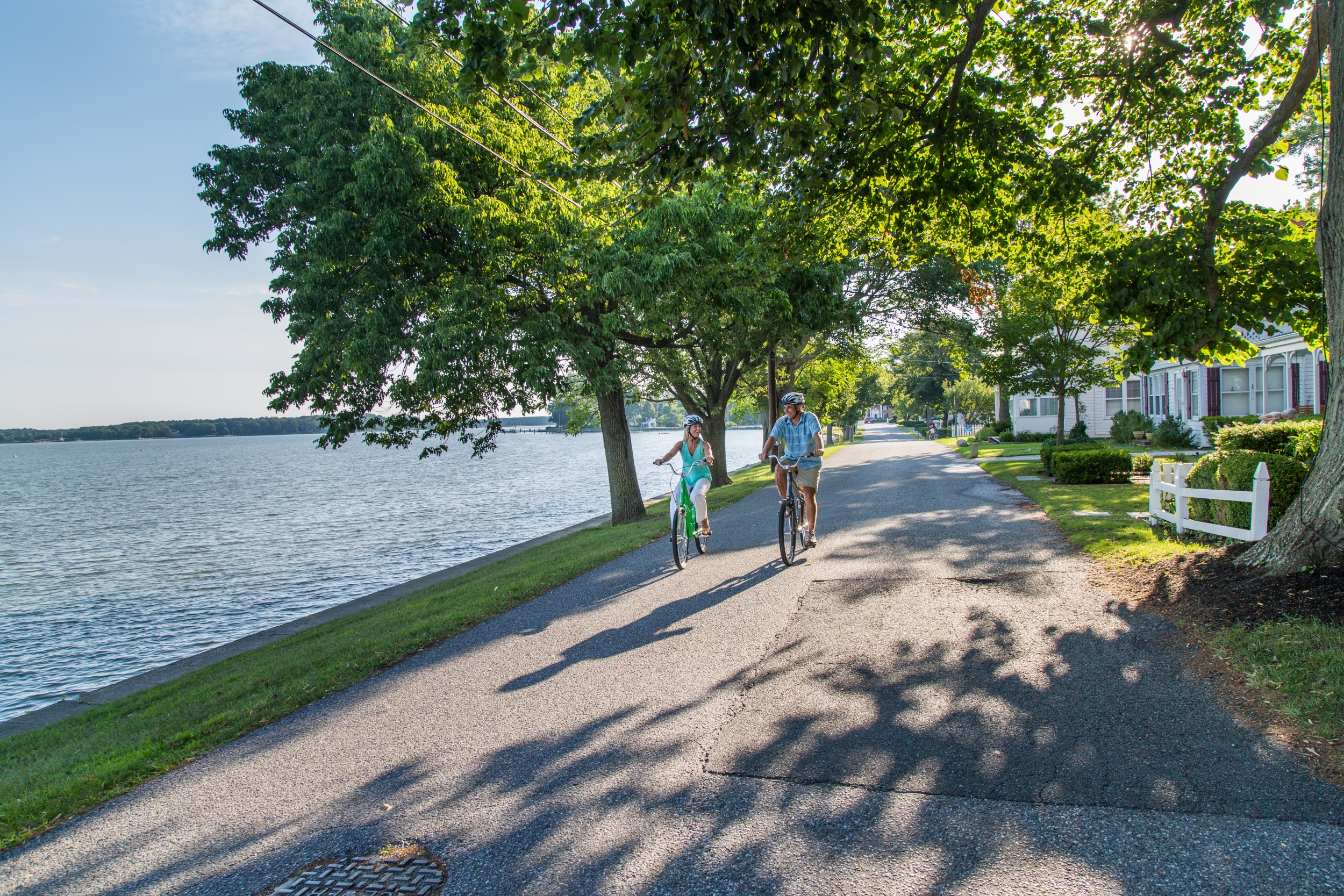
To this day, Talbot County is far more easily navigable by water than by road — its hidden gems accessible whether you’re paddling a kayak, powering a cruiser, or exploring under sail. Modern-day watermen and women ply these waters with their powered workboats and the few remaining skipjacks, harvesting the bounty of the Bay to be sampled fresh at local restaurants.
Now that recreational sailboats and powerboats with fiberglass hulls have come to outnumber wooden workboats, and roto-molded plastic kayaks have replaced dugout canoes, Talbot County’s waterways have opened up to nautical adventurers of all sorts.
The rivers and creeks here are remarkable for their pristine beauty and tranquility. This is where you go to get away. Where you get to ogle magnificent waterfront estates, some dating back to colonial times. Where you get to spot eagles, ospreys, great blue herons, and the thousands of migrating winter waterfowl: Canada geese, snow geese, tundra swans, and myriad diving ducks.
By Power and By Sail
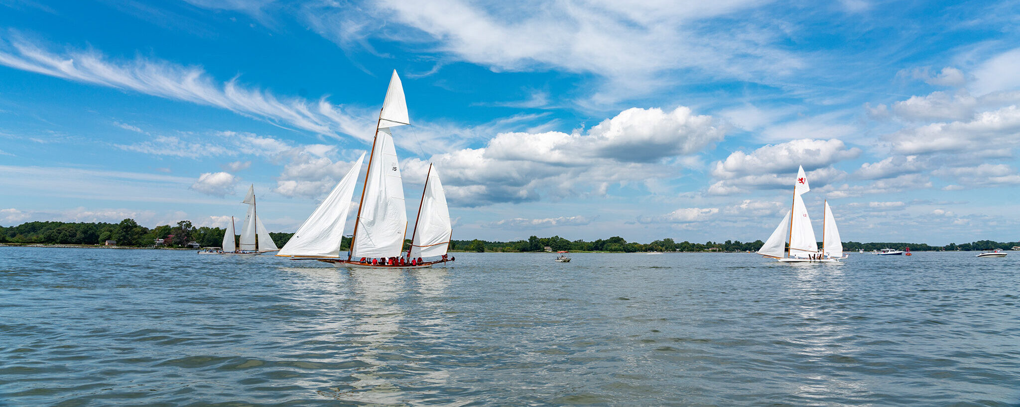
For cruising sailors and powerboaters, St. Michaels has long been considered the premier destination on the Chesapeake Bay. Its historic charm, its walkability, the delightful array of choices for dockage and dockside dining, and its proximity to Annapolis and Baltimore make it a must for any summer itinerary.
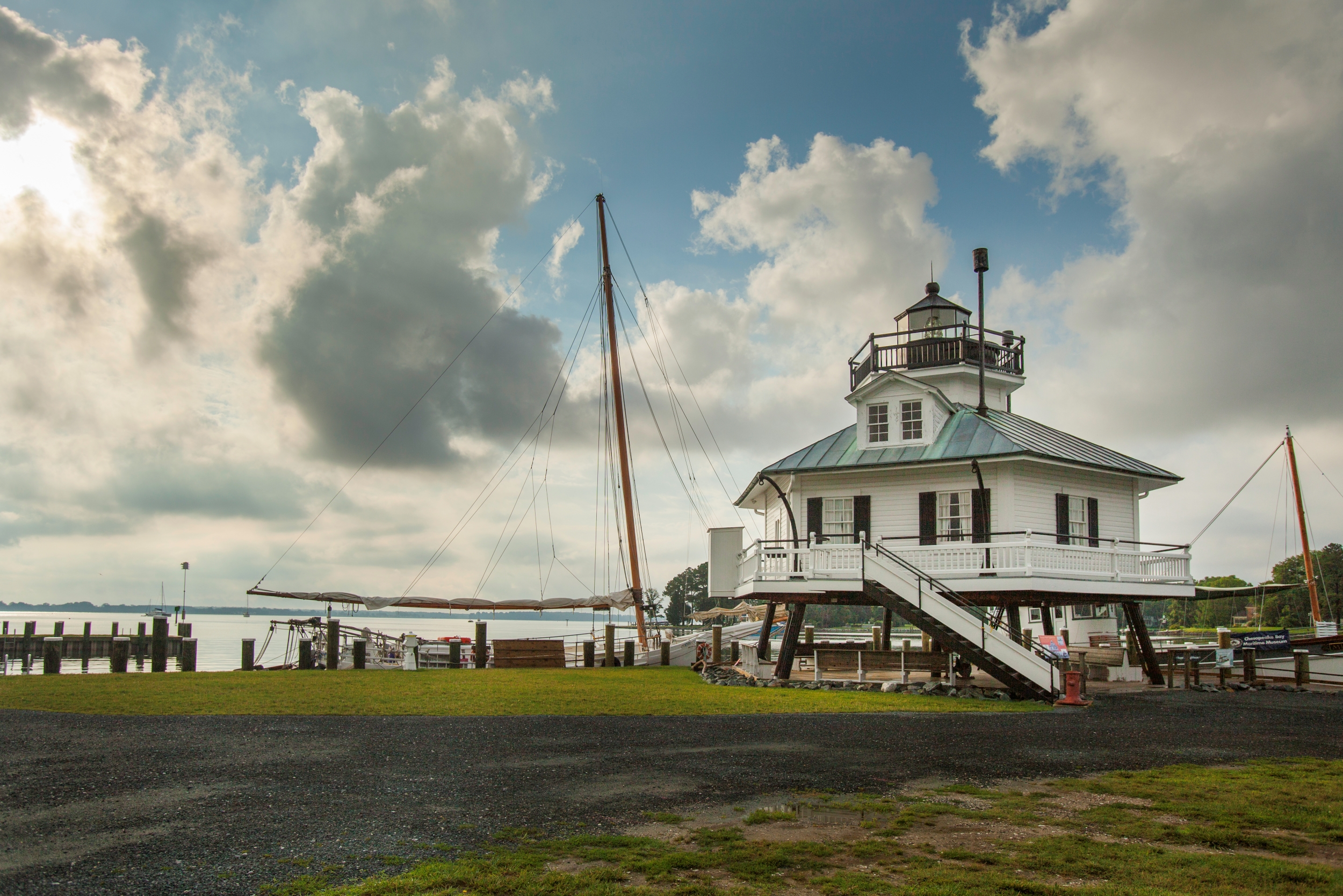
Docking at the Chesapeake Bay Maritime Museum brings the added grace of hanging out among traditional watercraft in the shadow of the Hoopers Island screw-pile lighthouse, with the aroma of crabs steamed in Old Bay in the breeze. It is the essential Chesapeake experience.
Marinas and Dining
Oxford runs a close second, with its tree-lined main street rolling down the narrow peninsula between the Tred Avon River and Town Creek, and is just as charming to visit. It’s well blessed with marinas and an inviting variety of dining opportunities.
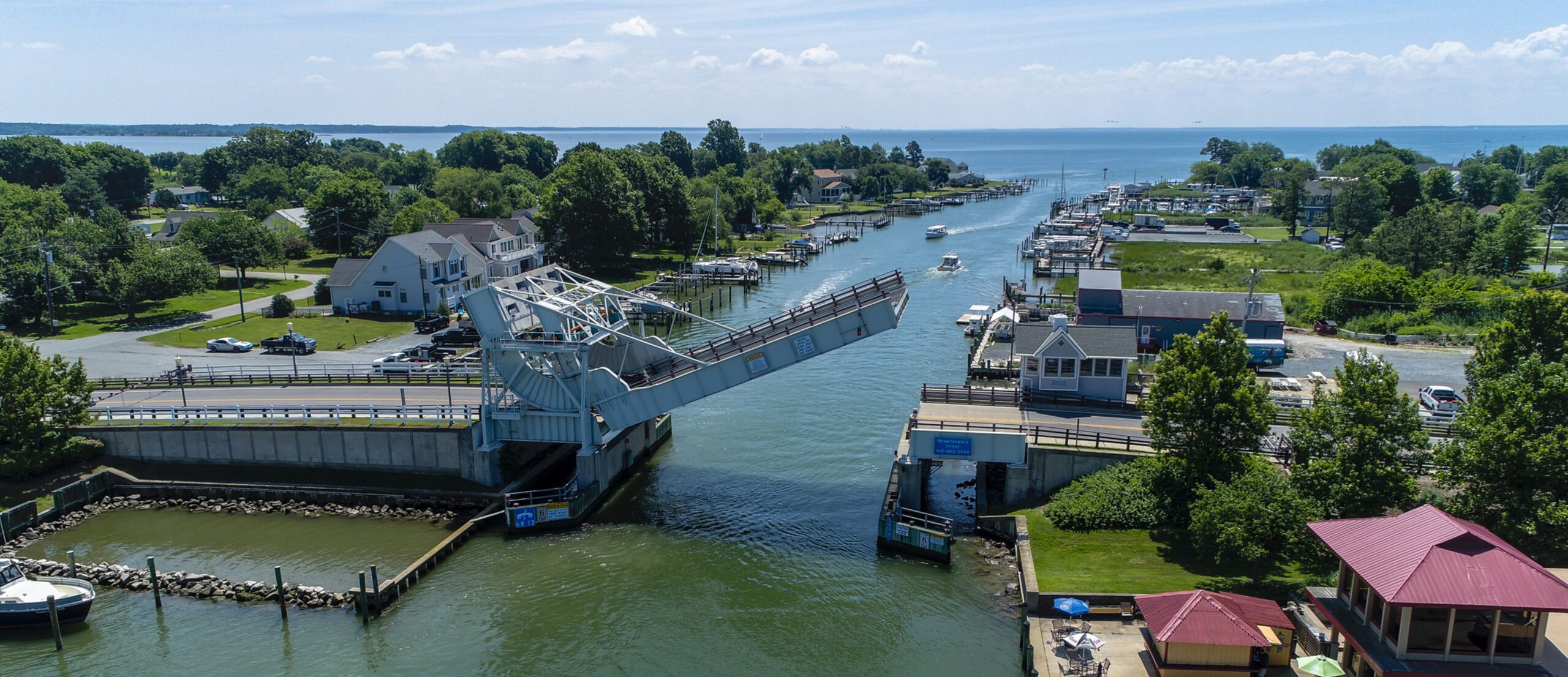
Knapps Narrows at Tilghman Island is yet another popular stop-in spot, and home port for many of the county’s working watermen and women. There are several marinas, inns, and waterfront restaurants, plus a number of places on the island worth taking the time to visit. At Dogwood Harbor on Harris Creek, you’ll find a collection of some of the last working skipjacks afloat.
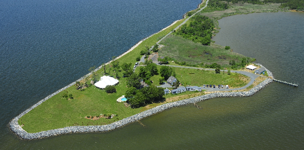
Knapps Narrows also provides a convenient shortcut between the open Bay and the Choptank River. Just outside of the narrows on the Bay side, you’ll see Poplar Island, an ongoing project by the US Army Corps of Engineers and the Maryland Port Administration designed to restore one of the Chesapeake’s many disappearing islands. The island once covered 1,100 acres on the hydrographic chart of 1847, but erosion caused by storms, climate change, and sea-level rise shrank it to 5 acres of soggy marsh by 1993. Since then, engineers have outlined the 1847 margins of the island with a high wall of riprap, and they’re filling it in with silt and sand dredged from the ship channel between the Bay Bridge and the entrance to Baltimore Harbor.
Insiders Tip
Old salts will tell you to keep a weather eye out on the western horizon, the direction from where most of the summer storms come charging across the Bay. Free smartphone apps can provide up-to-the-minute radar scans, providing plenty of time to duck into one of Talbot County’s many protected anchorages before the first gust of wind can blow your hat overboard.
Secret Hideaways
The real allure of Talbot County waterways, however, lies not in the populated villages, but in the isolated anchorages, which abound in the rivers and creeks.
Head up Eastern Bay and there, tucked behind Bennet Point, you’ll find the idyllic Wye East River, which forms the county’s northern border. Just inside the mouth, the river opens up onto the protected Shaw Bay.
Heading down Eastern Bay, there’s Tilghman Creek just inside Rich Neck at the mouth of the Miles River. Before you get to St. Michaels, you can duck into Long Haul Creek on one side of the river or Leeds Creek on the other. Hunting Creek is just upriver from there. In these placid spots, you’ll find protected anchorages surrounded by fields and forests and shorelines dotted with graceful waterfront estates.
Sail around Black Walnut Point at the southern tip of Tilghman Island and into the Choptank River to discover even more hidden gems like Harris Creek, Broad Creek, and the Tred Avon River. Head up the wide mouth of Broad Creek, graced with a multitude of quiet anchorages, like the one in Balls Creek near the tiny waterman’s village of Neavitt, and Leadenham Creek, where you’ll find the charmingly named Baby Owl Cove. Further up Broad Creek, you’ll run into San Domingo Creek, where you can visit St. Michaels through its “backdoor.”
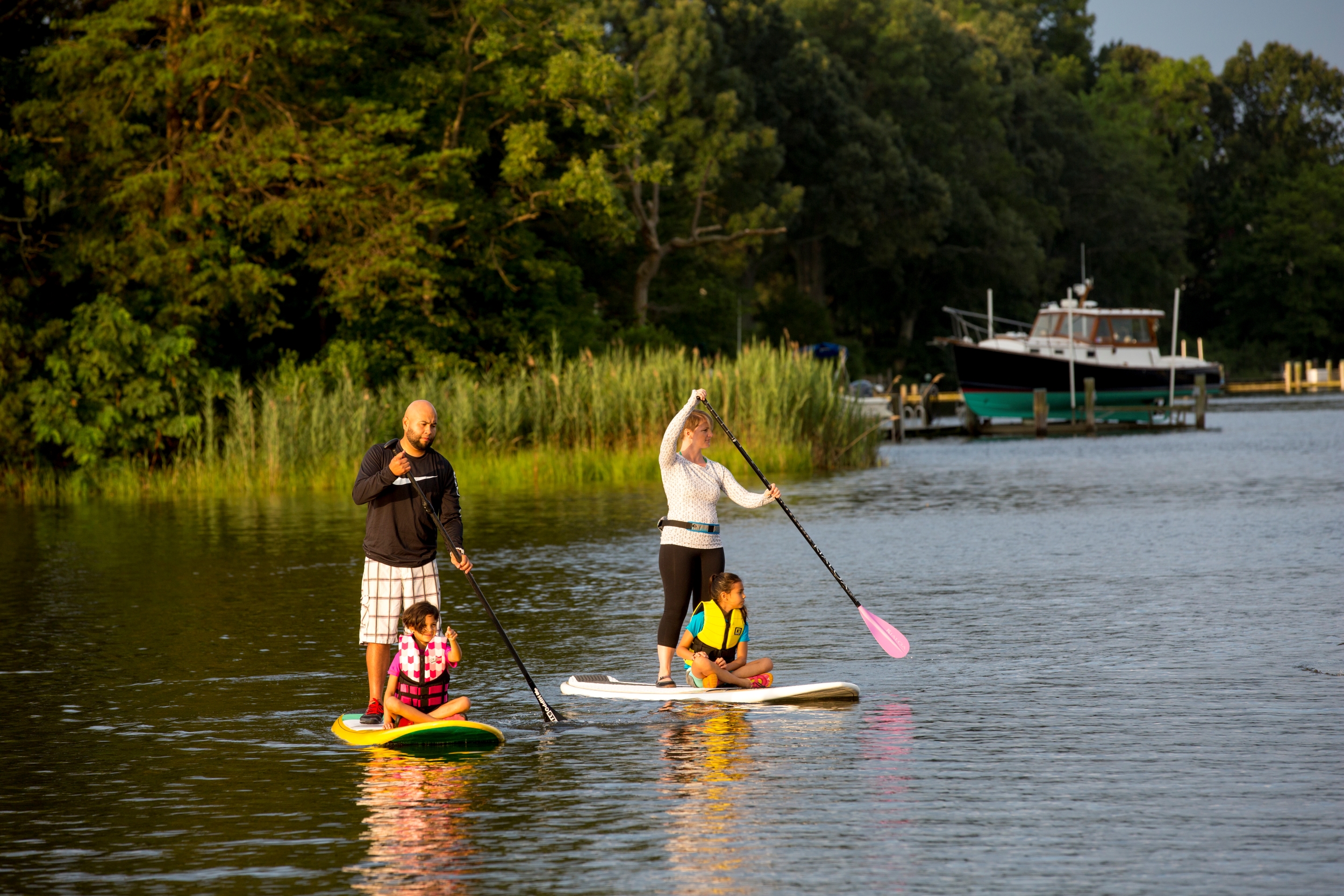
Powered by People
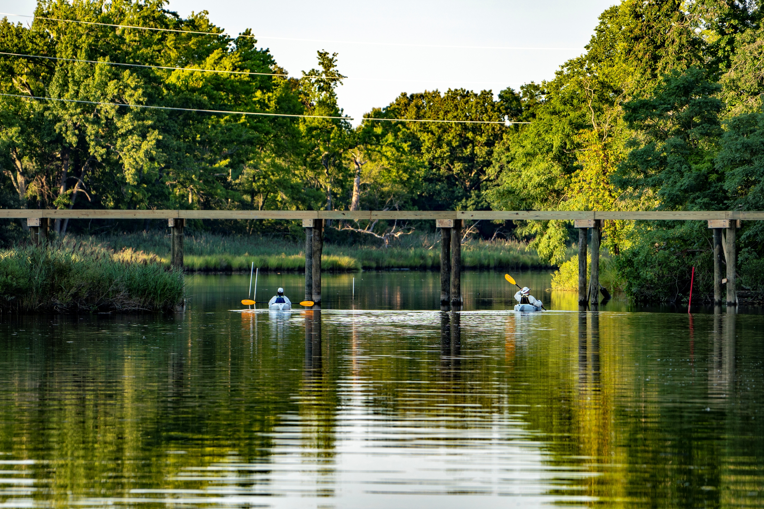
While Talbot County’s waterways are wonderful for powerboats and sailboats, they provide even more opportunities for exploration with people-powered canoes, kayaks, and stand-up paddleboards. Smaller watercraft can roam freely along the miles of Talbot County’s shoreline, in shallow water and marshes where larger boats are limited by the depths of their keels.
There are dozens of put-in sites where you can launch your car-top boat, and Talbot County presents some of the best in its St. Michaels and Tilghman Island water trails maps. These trails provide excursions ranging from quick loops in protected coves to longer cruises along the open Bay shoreline. Pick one that fits your time frame and go exploring, whether you’re an experienced paddler or still trying to figure out which pointy end goes first.
Printed on glossy waterproof paper, hard copy maps are available. Each trail includes driving directions to the launch site, the distance covered, and the suggested time allocation, along with cautions about the tidal currents, wind, weather, and the boat traffic conditions you can expect to encounter.
The water trail maps are an excellent source of other information you can use to plan your explorations of Talbot County’s rivers, creeks, and Chesapeake Bay shoreline, time and again.
Small Craft Safety
Wear a properly fitting personal flotation device (PFD) at all times.
Know your location, where you are going, and how to return. Let someone back home know your plan, and avoid paddling alone when possible.
Check the weather before departing, and continue to monitor, as storms can come in quickly. Try not to paddle away from shore farther than you can swim.
Dress appropriately for the weather and water temperature. If you enjoy cold-weather paddling, consider a dry suit.